Saturday, October 22, 2011

First Snow

Last week (October 13th) was our first measurable snowfall of the year. It was a little late according to some people but that's ok, it will be hanging around for a really long time! We only got about 2 1/2 to 3 inches, but it is so cold none of it is melting. The thermometer read 10 degrees that morning and as one of my friends would say "welcome to the icebox"....

Here is the driveway and the thermometer on the porch:


Wednesday, October 5, 2011

Evaporation fog

Woke up this morning and the thermometer on the porch read 18 degrees F, the coldest yet! No significant snow yet, but it is on the way. The ground and all the trees were all white with frost, in the sun it sparkled like diamonds.

The lake across from the cabin had a thin layer of steam fog advecting across the surface. It is caused by a cold air mass passing over a warm moist surface, this is also why it as known as evaporation fog. In this case the lake has not frozen over yet and is warmer than the air temperature (even though that lake is no where close to being warm enough to swim in).

Sourdough Fuel

I had mentioned before that the cabin is heated by heating oil. Today I finally got my fuel delivered by Sourdough Fuel. It was definitely a new experience. It's basically a traveling gas station that comes to your front door. I know I probably sound silly, but it's not every-day-living when your house, I mean cabin, is ran off of oil from a tank that sits right outside your stoop.

Anyways, the delivery was this afternoon and the delivery man pulled the hose from the tanker and filled it up. He said the oil comes out at a rate of 55-65 gallons a minute. It literally took him longer to back the truck up than to fill the tank. I think he thought I was crazy because I was asking questions and taking pictures, oh well!!! 


Tuesday, October 4, 2011

Wickersham Dome

Last weekend we had this great idea to head to the arctic circle. It's about 150 miles north of Fairbanks on the Dalton Highway. Alex and I got a really late start thinking that normally 150 miles wouldn't take that long, but we both didn't know that the Dalton Highway is a dirt road that follows the pipeline all the way to the Beaufort Sea!

I'm not sure if anyone knows the t.v. show Ice Road Truckers on the Discovery Channel, but  the ice road that the truckers travel on is filmed on the Dalton Highway. We started out in the afternoon thinking we would be back before sun down, as we got further away from town we both realized that this trip would not be doable.

To make it feel as if the whole day was not a waste Alex and I found a trail and went for a hike. We pulled off the highway and turned into the Wickersham Dome Trailhead. These trails are designed for mushers, so we didn't have the time or resources to do any of the full loops (20-30 mile loops and some go out 100 +). We just did an out and back, which was roughly twelve miles round trip. It's really neat, these trails are maintained by BLM and there are cabins along the trail that you can reserve and stay the night. It would be neat to snow shoe or cross country ski in and stay the night. The trails/cabins would be perfect for viewing the aurora borealis.

The whole time walking through these trails I was nervous we would run into a bear or moose. There was a lady and her dogs who we stopped and talked to for awhile. She had her gun and bear spray on her and that didn't calm my nerves!! All we saw though were a ton of moose and caribou tacks, oh and fox poop!

I didn't get a lot of good pictures, it was overcast and really hazy. I tried to get some good ones and here they are.  

We took the Summit Trail and made it to the summit:


This would be perfect for viewing the aurora, there is a fire pit and the view goes for miles:


I think I forgot to mention it was cold!! We estimated that it was maybe 38 F, there was snow in the shady spots and the creeks were frozen over:


The only animal we saw was a ptarmigan. They are normally a brown color in the spring/summer months, but during the winter they turn white as snow:


The view from the summit looking toward the arctic circle. The picture doesn't do it justice and I wish the camera wouldn't pick up so much haze, but it was beautiful from the top. There was a cloud bank off in the distance sitting on the Brooks Range and seeing that made the whole trip worth it.


On our way back the sun was starting to set and I snapped this shot:


Monday, October 3, 2011

The Pipeline

If you were ever wondering where a lot of (all) the oil the U.S. likes to hoard comes from, well here you go... It all begins in Prudhoe Bay, on Alaska's northern slope where the largest oil field in North America is located. It spans a wide 15 miles by 40 miles. The oil is sent through a pipe, which travels 800 miles from the north slope to Valdez, Alaska. Not only does it travel 800 miles, it crosses 3 mountain ranges, 34 major rivers and 800 smaller rivers. Pretty neat, huh!?!?!


Last weekend a friend of mine, Alex, and I wanted to get out of town, so we cruised a couple miles north and stumbled upon the pipeline. The pipeline travels above ground, as well as, below and the pipes have a diameter of 48''. Here's the pipeline: 


If you can click on this picture to enlarge it you should read the pipeline history and stats:


Sunset


Last Friday evening on my way from work/school I drove into this beautiful sunset. The colors were so vivid, it was certainly a great way to end a hard week. Of course it got me thinking of the science behind it all and I know you are wondering the same thing!!

So here it is...as the light travels from the sun to earth it is considered to be white light and as it travels through the earth's atmosphere a portion of that light scatters off molecules and other particles (dust, air pollution etc). This scattering gives the bright blue color that is visible to us at the surface. A British physicist, Lord Rayleigh, discovered this phenomenon and is known as Rayleigh Scattering. At sunrise and sunset the path through the atmosphere is longer and the shorter blue and green wavelengths are completely removed leaving the longer red and orange wavelengths. When clouds are visible in the atmosphere they also help to scatter light, which is known as Mie Scattering. With out the clouds to scattered the light the horizon at sunset is a light red/orange color while the rest of the sky remains blue.

But enough science! Check out this sunset right outside the cabin...


 A few minutes later:


Several minutes later from the porch:

Friday, September 16, 2011

My Little Corner of the World

I can not be more thankful for everything that the Lord has given me. I have still not fully grasped the idea of being here. Everything is different; the smell of cool crisp air, the sunlight as it creeps through the thick boreal forest, the dome like sky sits overhead as the clouds seem to be just out of arms reach....it's beautiful!!!

When I'm not in class, I am in my cubicle!! I received  a researching assistant position at the International Arctic Research Center (IARC) which is located on upper campus. I do research for two researchers: Dr. Georgina Gibson and Dr. John Walsh. They are the best, both of them have done everything possible to get me settled in here and made sure it all went smoothly. The research is really interesting. Here is an overview of what it the research focuses on:

It is titled  “Ecosystem Impacts of variability and extreme events in the Arctic”. The project aims to quantify the ability of the Community Earth System Model to capture ecosystem-relevant variability in the Arctic over seasonal to decadal timescales, and to perform off-line simulations, with regional scale ecosystem models, to evaluate the sensitivities of ecosystem components to extended-duration forcing anomalies and extreme events (Gibson 2011).   


This is the entrance to upper campus with the Museum of the North in that background...really cool architecture.


This is IARC where the Department of Atmospheric Science (DAS) is located and where my office is located. Really the department is split between those two buildings IARC is the building on the left and the Geophysical Institute (GI) is on the right.  


This is my cubicle on the 4th floor of IARC


Here is the view from the 4th floor....that's the Alaskan Range


 View from standing outside IARC


 See the trail? there is a huge network of trails all over Fairbanks this goes down to the cabin..

Looking towards downtown Fairbanks

The Cabin

Here in Fairbanks, Alaska it's all about the dry cabins. When I say dry I mean absolutely no running water and no plumbing. All you have is a roof over your head and a toyo heater to warm you up! The locals haul water back to there cabins two ways: 1) most people place large water tanks in the bed of there pick-up and fill up every few months or 2) people buy 5 gallon jugs and fill up every few weeks (this is the route I chose, since I don't have a truck). You might be asking yourself, why dry cabins? Since the ground is frozen (permafrost) for several months out of the year, it makes it hard for all the proper construction to take place. The closer you get to the coast the less dry cabins you see. I met people form Juneau the other day and they had said that living in a dry cabin was very new to them as well! 

Not everyone lives this way in Fairbanks, but it is very popular within the college community. It's not as bad as it sounds, but then again it's -40 degrees outside yet!

Autumn was just starting when we arrived in Fairbanks. It is now in full swing, the colors are amazing to see. From my office I can see the whole valley and the view is just stunning...


So, here is our new home taken just a few days ago:

This is the street Roland Dr, which the cabin is on


Now when you drive down the road the cabin sits off to the right about 1/4 mile, here is the driveway

the cabin...notice the outhouse!!! right next to the outhouse there is another wooden structure...that's where you pour all the grey water that you use.


Now I had mentioned a heater...it runs off of oil and they are really efficient (in cost and heat). What you do is fill your tank up with oil once a winter and run your heater off that tank, it acts like a well for water. Depending on how much you use your heater determines how much fuel you need (duh right!!), but they say that anywhere from 150-250 gallons should do it. I think our tank is roughly 300 gallons, maybe a little more.


This is the backyard, not much of a backyard! It is linked to trails that go all the way to campus.


The front yard from the pourch


Just on the other side of the trees it opens up to field that follows the power lines, good for an easy hike.

looking west

looking north
 
here is the kitchen inside that cabin. There are no cabinets for glasses or pantry for food, it's very simple. Everything about the dry cabin life style is simple!!


It's like camping...you buy a jug, fill it up with water, place the spout over the sink and do work!!


Where does it drain, you ask??? Well it goes into a bucket, hahahahaaa!! No joke the sink drains into a bucket underneath. When it's full you just take it outside and pour it down the whole next to the outhouse. I haven't really got used to washing your dishes, washing your face and brushing your teeth all in the same sink...it bit weird, but it works!


I guess another thing I am still getting used to is taking showers...since there is no plumbing there is no shower at the cabin. I got lucky and my office has two showers in the men's locker room. I just take showers before I leave to go home, not bad...

Saturday, September 3, 2011

In The Beginning

Michelle and I both decided not to speak of the "A" word, since it seemed to cause a lot of  headaches. As the deadline grew near and still no word from UAF (University of Alaska-Fairbanks), it seemed like postponing my admissions was the best option. On her lunch, Michelle called me to say hi and to see if there was any word yet. Within minutes my email account lit up with one new message from UAF asking me to contact them. One 20 minute phone conversation and one email later I am new student at UAF!!!

The planning and mapping began:


Going through Nevada, California, Oregon and Washington was easy. We weren't worried about that, it was Canada that freaked us out...cause at least in the lower 48 we can use our phones to get directions using the gps/mapping application. So i got out my road atlas and bookmarked all the states that would be traveled through. After bookmarking I took a highlighter to all the highways going to be driven. I was told to purchase a book that would greatly help our travels. It was certainly worth every penny. It's called the "The Milepost". It came with a huge map of Canada and Alaska (the book is open at the top of the map with the pink line). It has several routes that can be taken to reach Alaska and it has a mile by mile description of the road conditions, gas stations, camping/lodging and town information. "The Milepost" is truly the ultimate travelers guide.

So, Darwin (Michelle's dad) and I packed up a 5x8 U-Haul and the Jeep. the next morning we were off on our great adventure. It was really neat...the farther north we got, the on going joke was "this is now the farthest I have ever been," it seemed like we would say that every 5 minuets or so!
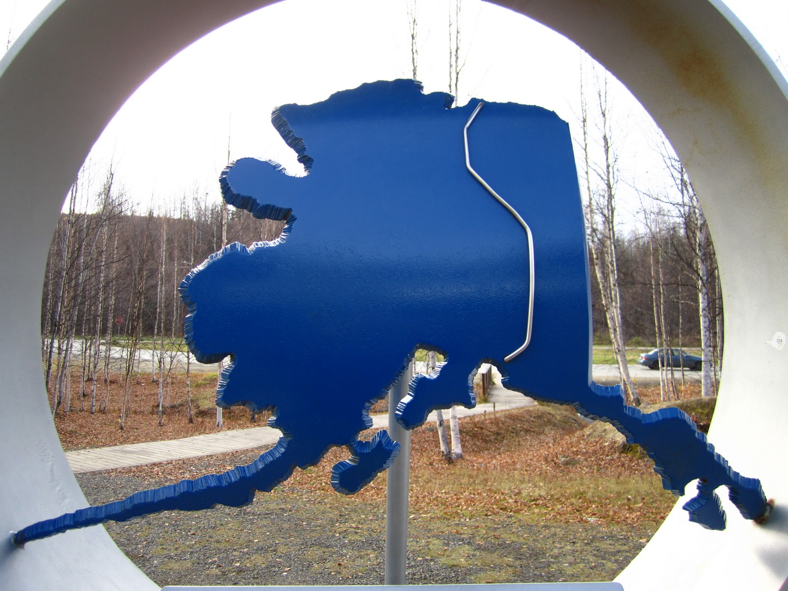
 Something I thought was really ironic was the morning we left I filled up with gas at the Smith's gas station across the street from Michelle's house in Reno. I forgot we needed ice for the food we were bringing on the trip. I went back and payed cash for the ice, well the cashier asked where we were headed and I smirked and said "not far!" But she was from Alaska and she handed me two quarters back in change. This is what I got:

 There was so much to see and so little time. I wish we could have had more time to do the tourist thing, but really we were on a deadline! Now here are a few shots we got along the way:

Mt Shasta

AHHH WRONG WAY!!


I asked Michelle to take pictures of cool bridges...Haha Michelle real funny!


The Cascade Mountain range in Washington


The border (good thing we are not aliens!!!)


Michelle doing her best Vanna White


British Columbia was beautiful


On the way to Alaska its not Chevron it's Husky! And that's 128.9 cents/Liter!!


As we got farther and farther north it got greener and greener. I always thought it would be these huge mountains with glaciers and people riding moose instead of driving cars, but actually BC and the Yukon is filled with flat (some rolling hills), thick boreal forest and large farming crops. The grass/trees are a vibrant green color, it was amazing to see...


 Our first "Beware of the Moose"


Then we found the mountains!


Through out BC the roads got washed out last winter due to a crazy amount of snow/ice/rain, so they are redoing large sections or the highway. The bummer is a dirt highway...


It was a good feeling making it over a 1,000 miles and getting to this point and seeing this sign...


Breakfast!! We didn't even make through one, notice the other on her lap...


Our first moose encounter...just a calf, but still a cool sight!


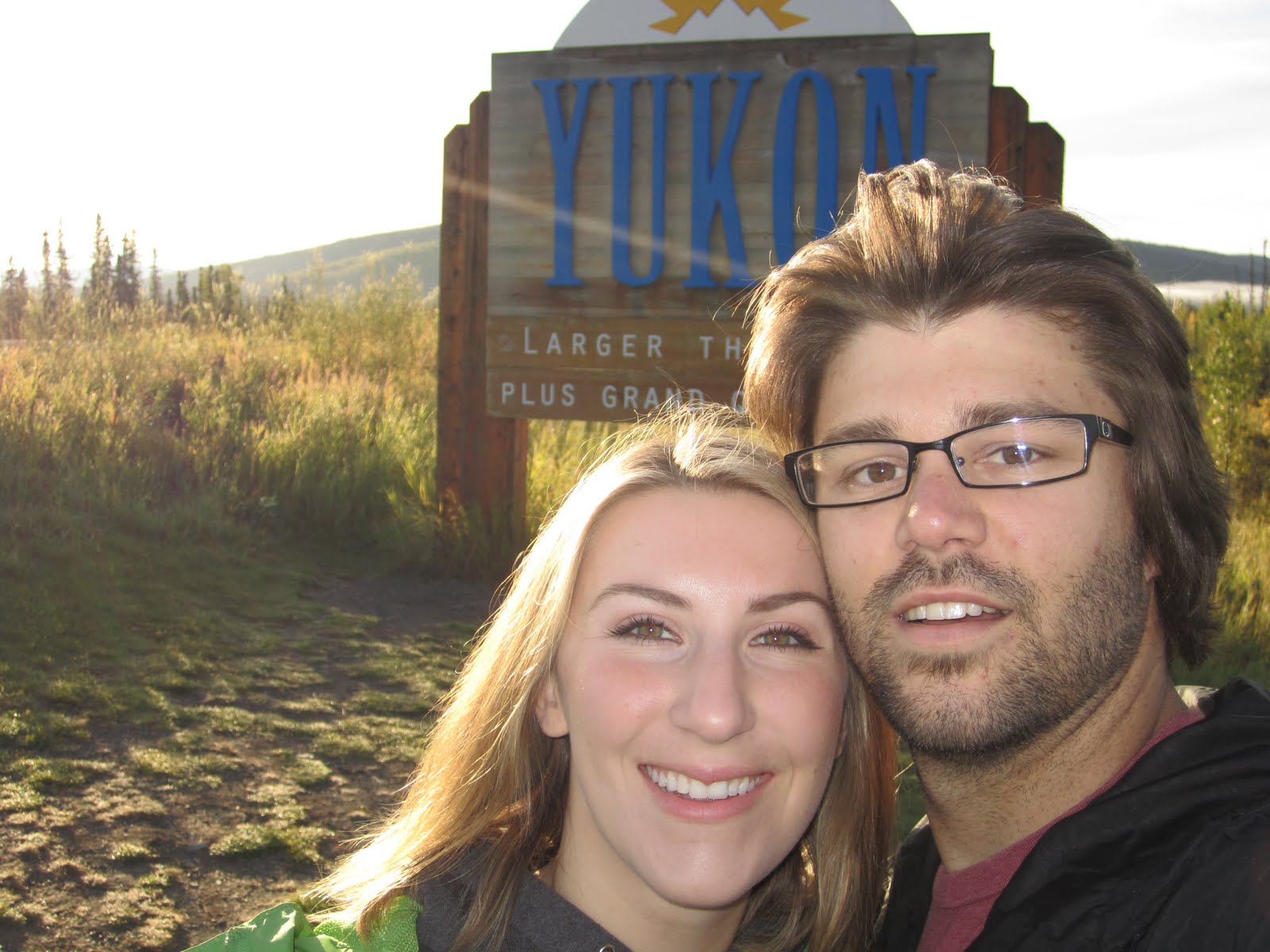
 Never did I think we would ever be in the Yukon Territory


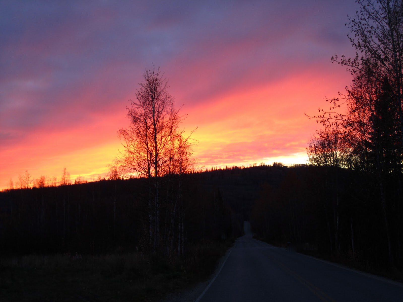
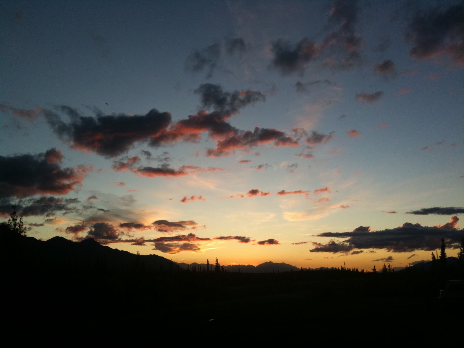
These next few pictures are some of my favorites from the trip. We were still in the Yukon Territory and they were taken around 11:00 pm at night!!!


Woke up in Beaver Creek, Yukon thinking it was still August...only on the calender was it August, the temperature said otherwise!


Tired eyes...five days of driving and 1 rowdy night with the Beaver Creek locals!


After 6 days...WE MADE IT!!


Hanging out on the International Border!


Just checkn' for bears!!


Welcome to Tok, Alaska!


Bush planes are everywhere here...

Rainbow over the Chena River running through downtown Fairbanks, Alaska...

Chena River


For the first few days in Fairbanks Michelle and I camped out at the campsite in downtown...although it didn't look like any downtown I had been to!!


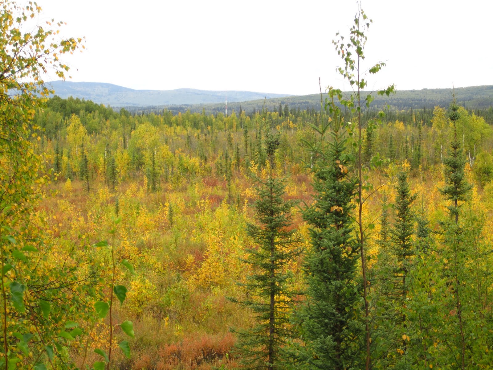
The other day I was feeling a bit overwhelmed with everything that has happened over the few weeks. So I drove to a local wildlife refuge to just clear my head and lose myself. I say drove, but really it's like a 2 1/2 miles from the cabin. It was really nice to get out and go for a hike...I took the boreal forest loop...it was, in a few words, amazingly soothing.


Since it is a wildlife refuge, it is a great place to animal watch. Moose like to feed on treelings that would usually grow back in burnt down fields. The fire crews keep wildfires out of the city limits (well, as much as possible) and the trees grow too tall for the moose to graze. So, they make theses fields by cutting down the trees to moose height so they are not pushed out of their habitat. But it also makes for a great picture!