The planning and mapping began:
Going through Nevada, California, Oregon and Washington was easy. We weren't worried about that, it was Canada that freaked us out...cause at least in the lower 48 we can use our phones to get directions using the gps/mapping application. So i got out my road atlas and bookmarked all the states that would be traveled through. After bookmarking I took a highlighter to all the highways going to be driven. I was told to purchase a book that would greatly help our travels. It was certainly worth every penny. It's called the "The Milepost". It came with a huge map of Canada and Alaska (the book is open at the top of the map with the pink line). It has several routes that can be taken to reach Alaska and it has a mile by mile description of the road conditions, gas stations, camping/lodging and town information. "The Milepost" is truly the ultimate travelers guide.
So, Darwin (Michelle's dad) and I packed up a 5x8 U-Haul and the Jeep. the next morning we were off on our great adventure. It was really neat...the farther north we got, the on going joke was "this is now the farthest I have ever been," it seemed like we would say that every 5 minuets or so!
Something I thought was really ironic was the morning we left I filled up with gas at the Smith's gas station across the street from Michelle's house in Reno. I forgot we needed ice for the food we were bringing on the trip. I went back and payed cash for the ice, well the cashier asked where we were headed and I smirked and said "not far!" But she was from Alaska and she handed me two quarters back in change. This is what I got:
There was so much to see and so little time. I wish we could have had more time to do the tourist thing, but really we were on a deadline! Now here are a few shots we got along the way:
Mt Shasta
AHHH WRONG WAY!!
I asked Michelle to take pictures of cool bridges...Haha Michelle real funny!
The Cascade Mountain range in Washington
The border (good thing we are not aliens!!!)
Michelle doing her best Vanna White
British Columbia was beautiful
On the way to Alaska its not Chevron it's Husky! And that's 128.9 cents/Liter!!
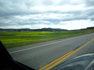
As we got farther and farther north it got greener and greener. I always thought it would be these huge mountains with glaciers and people riding moose instead of driving cars, but actually BC and the Yukon is filled with flat (some rolling hills), thick boreal forest and large farming crops. The grass/trees are a vibrant green color, it was amazing to see...
Our first "Beware of the Moose"
Then we found the mountains!
Through out BC the roads got washed out last winter due to a crazy amount of snow/ice/rain, so they are redoing large sections or the highway. The bummer is a dirt highway...
It was a good feeling making it over a 1,000 miles and getting to this point and seeing this sign...
Breakfast!! We didn't even make through one, notice the other on her lap...
Our first moose encounter...just a calf, but still a cool sight!
Never did I think we would ever be in the Yukon Territory
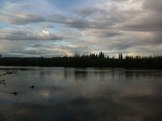
These next few pictures are some of my favorites from the trip. We were still in the Yukon Territory and they were taken around 11:00 pm at night!!!
Woke up in Beaver Creek, Yukon thinking it was still August...only on the calender was it August, the temperature said otherwise!
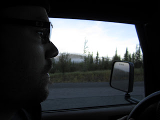
Tired eyes...five days of driving and 1 rowdy night with the Beaver Creek locals!
After 6 days...WE MADE IT!!
Hanging out on the International Border!
Just checkn' for bears!!
Welcome to Tok, Alaska!
Bush planes are everywhere here...
Rainbow over the Chena River running through downtown Fairbanks, Alaska...
Chena River
For the first few days in Fairbanks Michelle and I camped out at the campsite in downtown...although it didn't look like any downtown I had been to!!
The other day I was feeling a bit overwhelmed with everything that has happened over the few weeks. So I drove to a local wildlife refuge to just clear my head and lose myself. I say drove, but really it's like a 2 1/2 miles from the cabin. It was really nice to get out and go for a hike...I took the boreal forest loop...it was, in a few words, amazingly soothing.
Since it is a wildlife refuge, it is a great place to animal watch. Moose like to feed on treelings that would usually grow back in burnt down fields. The fire crews keep wildfires out of the city limits (well, as much as possible) and the trees grow too tall for the moose to graze. So, they make theses fields by cutting down the trees to moose height so they are not pushed out of their habitat. But it also makes for a great picture!


No comments:
Post a Comment